
Ash Meadows National Wildlife Refuge, Amargosa Valley, NV

Ash Meadows

Ash Meadows - Zeolite mineral deposits give rise to the green color. Zeolite is mined here.

Ash Meadows

Ash Meadows

Ash Meadows

Death Valley - view across Panamint Valley - SR 190 CA

Death Valley - on Emigrant Canyon Road to view coke ovens.

Death Valley - enroute

Death Valley - enroute

Death Valley - enroute

Death Valley - coke ovens. Coke was used to process ores.

Death Valley - opposite Zabriskie Point

Death Valley - at Zabriskie Point

Death Valley - from Fr. Crowley Vista Point

Cerro Gordo

On the road to Cerro Gordo - a dry Owens Lake in the background

On the road to Cerro Gordo - getting clolse to summit

Cerro Gordo - tortured landspcape

Cerro Gordo - mine site at summit - 9184 feet

Cerro Gordo - cook stove for miners - kept ready 24/7

Cerro Gordo - only remaining tavern on site (w/bullet holes in walls)

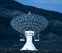
Owens Valley Radio Observatory - research explores cosmic microwave background radiation and star-formation.

Owens Valley Radio Observatory

Yosemite NP - early morning mist waiting for sun

Yosemite NP - Half Dome in shadow

Yosemite NP - persons in shadow, watching Half Dome

Yosemite NP

Yosemite NP

Yosemite NP

Yosemite NP - band at lower 1/3 is Tioga Road on other side of the Valley

Yosemite NP - view from Glacier Point

Yosemite NP

Yosemite NP - El Capitán - 3,000 feet from base to summit, atracts climbers

Yosemite NP - ready to go

Yosemite NP -

Yosemite NP

Yosemite NP

Yosemite NP - a favorite 'daring' photo site only 10 feet from paved walkway

Yosemite NP - Half Dome at early evening

Yosemite NP - Half Dome reflected in waters of the Merced River

Yosemite NP - one of many vistas met on departure

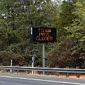
Yosemite NP - next stop was only 75 miles away, but the route was closed by snow. A second route (Sonora Pass) was also closed.

SR 4, CA - Ebbets Pass was open. However, it added 250 miles to my destination. Note: here the road is too narrow for a center line,

SR 4, CA - and frequently it was above clouds.

Bodie, CA

Bodie, CA - the mining center

Bodie, CA - miner's dwellings

Bodie, CA - note the school house

Bodie, CA - heavy duty machinery eased miner's chores.

Bodie, CA

Bodie, CA

Bodie, CA - a view down Green St, ending at the Medhodist Church

Bodie, CA - living room of a miner's house

Bodie, CA - the kitchen